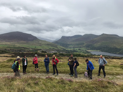
After an evening of exploring regional archaeology with regional archaeologist Rhys Mwyn, it was time for a day of exploring regional archaeology with regional archaeologist Rhys Mwyn. I packed my bag with waterproofs, flasks, and a lunchbox, and drove west. When I drove into the street where the meeting place was, I already saw a little cluster of fairly colourfully-dressed people, and knew I was at the right location. I parked up and joined them.
This walk would start in Carmel, walk south around Mynydd Cilgwyn, over a path that provides a view over the Nantlle quarries, then to y Fron, and from there around Alexandra quarry (also known as Cors y Bryniau; see links in previous post), around Moel Tryfan, down the old incline, along the local cemetery and then back to where we had started.
Rhys started talking some social history about the row of houses we were standing by. These were 30s council houses, replacing the original quarryman's cottages that had been there before. But he said human occupation here went a lot further back then that; he told us to look into the field on the other side of the road. If you know what you are looking for, you would recognise a ridge and furrow pattern, indicating medieval farming.
When we walked around the hill he pointed out houses where several of his ancestors had lived, and he told the tale of one of them who had killed himself when he got old and felt he was a burden on his loved ones. Not much has changed since. He also showed us the ruin of the house where his father had been born. It seemed it was already a ruin when Rhys was a small child. That was a pity! These houses were tiny, but very scenic, and we all were dreaming of doing them up and living in them. Maybe it would need several of them combined for a modern family, but that could be arranged. The last house in the row, where another of his ancestors had lived, had a slate storm porch still mostly surviving. It seemed to be the best one in North Wales!
 |
| The storm porch |
 |
| The pigsty of the house with the storm porch. Notice spoil heaps in the background. |
The next stop was a wall that went straight up the slope of the hill. It seemed to have been built by Penrhyn estate, at the time when Lord Penrhyn was alleged to have been engaged in a big and shameless land grab. He stood accused of having done the same in Mynydd Llandygai. Rhys said the story was that the estate built the wall during the day, and that when the quarryman walked past on the way home at the end of the day, they pushed it all down again. It's a nice story but that wall was still in excellent nick in 2021, so it looked like big capital won there. He didn't say anything about the quarries we could see below.
 |
| Rhys talking about the wall with Nantlle Valley in the background |
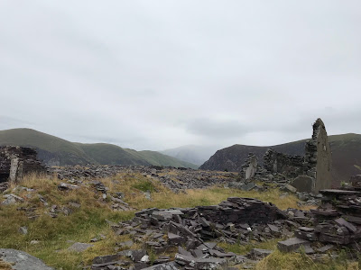
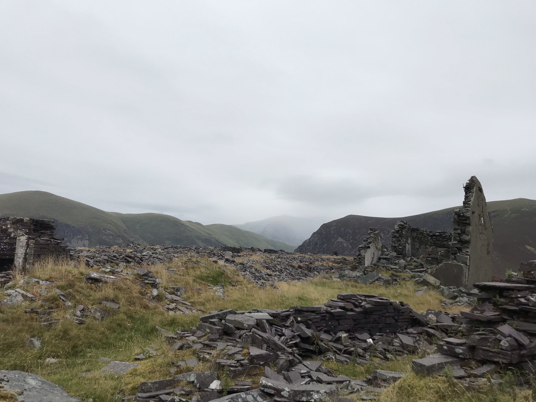
Later he drew our attention to the old tramway that snakes around, trying to not get too steep, and to the little lake that provided power to the quarries below. And then we walked past another disused quarry to Alexandra quarry, which is still in use. There are days when he can take his groups through the quarry, but there was activity in there, and there was a new sign on the gate, and that all meant that we had to walk around. That was fine! And it was approaching lunchtime. So when we got to the top, we just descended into a cluster of ruined buildings to sit down for lunch.
 |
| Lone archaeologist descending towards our lunch location |
 |
| Lunch! |
 |
| there is rain approaching |
After lunch we walked on. Around the hill we got a view over Rhosgadfan, which was the birthplace of the famous Welsh author
Kate Roberts, of whom
I had read the most famous book. The road after which her autobiography was named, y Lon Wen, was in view as well. I really should visit
her old house once it opens again! But we walked on. We walked down the old incline, and headed back to Carmel. When we were passing a cemetery, Rhys stopped again and told us that in a nearby field, there were some strange round stone structures of which he had no idea what they were. I think I identified one on aerial imagery at 53° 04' 39.13'' N, 04° 15' 31.76" W. Hard to know without any further information if they are Stone Age structures, or maybe just the product of the weird sense of humour of some 70s farmer with too much time on their hands, if there was such a thing.
 |
| spoil heaps and flowers |
By then it had been 2 p.m. and we were almost back where we had started. And a little table was set up in the garden, with tea and cups and biscuits and books Rhys had written and was selling, and a little bucket for our financial contributions. We had a right old natter in the drizzly garden! And all of the books that dealt with North Wales were duly sold. For some reason, there was less interest in the South Wales version…
So what was my verdict? It had been a beautiful walk, but the amount of archaeological knowledge conveyed was not huge. It was nice to do this walk with a lot of other people, mainly Welsh speakers, but I can't say I came away with a much deeper understanding of the deep history of the landscape there. So will I do this again? Very well might! But I think I will treat it more as an opportunity to practice Welsh than as a quest for buckets of archaeological knowledge. I bought the North Wales book; I could imagine that that is going to take over as my source for a lot of archaeological information from the region. I'm sure I'll get more walk ideas out of that!


No comments:
Post a Comment